


According to the India Meteorological Department (IMD), Cold wave conditions are very likely in isolated pockets over Himachal Pradesh on January 3 and January 4.
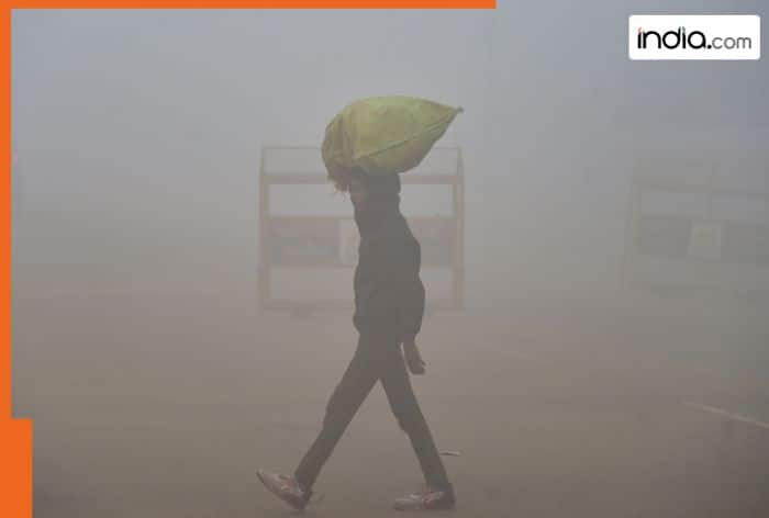
IMD Weather update, January 3, 2026: A ‘yellow’ alert has been issued for Delhi, as dense fog is likely to affect visibility in the national capital on Saturday morning, the India Meteorological Department (IMD) said. The weather office said a cold wave is expected to affect isolated places in the city between January 3 and January 6. Dense fog and severe cold wave conditions are being reported across the country.
According to the India Meteorological Department (IMD), Cold wave conditions are very likely in isolated pockets over Himachal Pradesh on January 3 and January 4; Haryana and Chandigarh during January 3 to January 6; Punjab during January 4 to January 6; Rajasthan on January 8 and January 9, 2026. “Cold day conditions are very likely in isolated pockets over Himachal Pradesh on January 2, Bihar on January 4, and January 5, 2026,” IMD added.
The weather agency added that Dense to very dense fog conditions are very likely to continue during night/morning hours at many/some places over Punjab, Haryana, Chandigarh till January 7; West Uttar Pradesh till January 5; East Uttar Pradesh till January 5 and during January 8 and 9; Odisha till January 6, 2026.
Dense fog conditions are also likely during night/morning hours in isolated pockets Jammu division, north Madhya Pradesh till January 6; Himachal Pradesh, Uttarakhand, Assam and Meghalaya, Nagaland, Manipur, Mizoram and Tripura till January 6; Punjab, Haryana, Chandigarh on January 8 and 9; West Uttar Pradesh during January 6-9; East Uttar Pradesh on January 6 and 7; Rajasthan, Chhattisgarh, West Bengal and Sikkim on January 3 and 4; Jharkhand till January 5; Odisha on January 7; Arunachal Pradesh till January 5 and Bihar till January 8, 2026.
January 3: Mainly clear sky. Moderate fog at many places with dense fog at isolated places during
morning hours. The maximum and minimum temperatures in Delhi are likely to be in the ranges of
17°C to 19°C and 6°C to 8°C, respectively. “The minimum temperature will be near normal, and the
maximum temperatures will be above normal (0.3°C to 2.3°C) over Delhi. The predominant surface
wind is likely to be from the west direction with wind speed less than 10 kmph during the morning
hours. The wind speed will increase, becoming less than 15 kmph from the northwest direction in the
afternoon hours. The wind speed will decrease, becoming less than 10kmph from the northwest
direction during the evening and night,” IMD in its press release said.
January 4: Mainly clear sky. Moderate fog at many places with dense fog at isolated places during
morning hours. The maximum and minimum temperatures in Delhi are likely to be in the ranges of
18°C to 20°C and 6°C to 8°C, respectively. India Meteorological Department (IMD) said, “The minimum temperatures will be near normal, and the maximum temperatures will be near normal over Delhi. The predominant surface wind is likely to be from the west direction with wind speeds less than 10 kmph during the morning hours. The wind speed will increase, becoming 15kmph from the northwest direction in the afternoon. The wind speed will decrease up to 10 kmph from the northwest direction during the evening/night.”
January 5: Mainly clear sky. Shallow to moderate fog during morning hours. The maximum and
minimum temperatures in Delhi are likely to be in the ranges of 18°C to 20°C and 7°C to 9°C,
respectively. “The minimum temperatures will be above normal (0.1°C to 2.1°C), and the maximum
temperatures will be near normal over Delhi. The predominant surface wind is likely to be from the
west direction, with wind speeds gradually increasing to reach up to 10 kmph during the morning
hours,” the weather agency added. The wind speed will increase to 15 kmph from the northwest direction in the afternoon, and then decrease to 10 kmph from the northwest direction during the evening/night.
Topics


